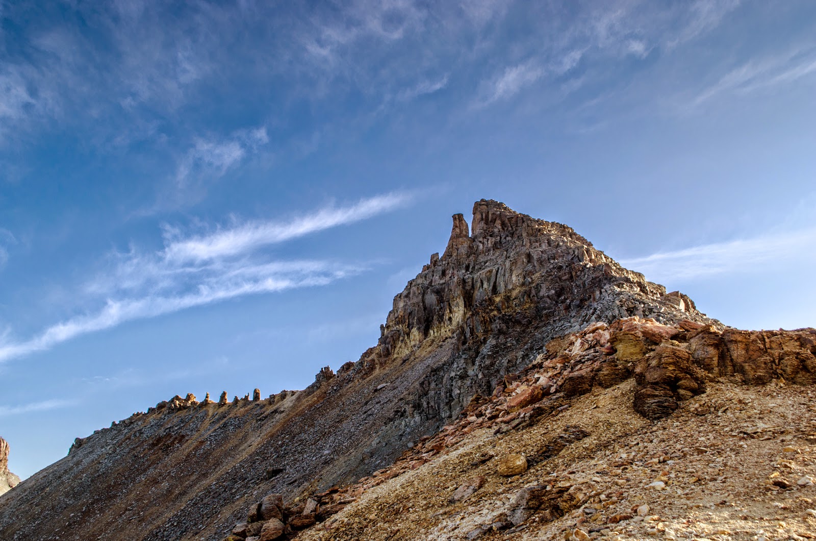
Summit Peak 13,300'
Archuleta County Highpoint
Southern San Juan Mountain Range
7/14/2018
In our continuing quest to climb all the Colorado County highpoints, I zeroed in on a cluster of peaks in the South San Juan Mountains. Summit, Conejos, and Bennett Peaks are all fairly close together. We had planned to do all 3 in one weekend, but sometimes, plans change. This "man trip" consisted of Avery, Scott, and myself.
We left COS around 3pm, drove straight to our camping area- Stunner Campground.
While I think Stunner might be a bit overstated, it's a nice little camping area. Here we were, in July on a weekend- there was only 1 other person here. We had the place virtually to ourselves. It's a free campground and it has a pit toilet!
 |
| View from our campsite |
 |
| The spot by the road was flat and soft |
Anyway, woke up at 5am and got on our way. From the campground, the trailhead area is 15-20 minute drive up gentle dirt roads. And I must say, the dirt roads were in great shape when we went there this year. Easy driving for any type of vehicle.
The night was.. interesting. It rained pretty well for an hour or so, as I drifted in and out of sleep. Not sure exactly how much. The only thing I know is that when we woke up EVERYTHING was soaked. But we were dry inside my tent. Best $200 I ever spent.
 |
| Sunrise, one of the benefits of getting up early |
The parking area could accommodate half a dozen vehicles, maybe more. We were the only people here.
It quickly became apparent that there wasn't much of a trail in places. We were bushwhacking through wet grass and plants. Luckily I had some GPS waypoints to follow.
One weird aspect of this trail. It is VERY lightly traveled. It's not well established. It's not easy to follow. Because of this, and the wet weather - we ended up soaked. My boots filled up with water. I ended up stopping at least 3 times before the summit to wring water out of my socks. Somehow, we did the whole hike without me getting blisters!
 |
| Forest typical of the lower elevations. Lots of beetle kill |
 |
| You climb into this beautiful basin |
We found a trail, then lost the trail, then found it again. It traverses a slope, then comes across a basin. All the plants were soaking wet.
 |
| At this point the trail was a muddy rut |
 |
| Heading up above treeline. Tons of beetle kill in the area. |
 |
| This is a beautiful place. |
Right after this photo was taken, something amazing happened. We heard elk bugling. It sounded awesome, but kind of eerie in a way too. We couldn't see them, but we knew they were around. And I must say, in climbing over 70 summits, we have never heard elk bugling as we were heading up in the morning. Quite a treat!
 |
| Summit Peak comes into view, finally. |
 |
| There it is! Summit Peak dead ahead. |
 |
| I believe this is "the Unicorn" and Montezuma. Typical San Juan beauty. |
 |
| Cool view, and look - there is wildlife there |
 |
| Zoom in a little, we see 4 elk! |
 |
| There's kind of a trail here, but I believe this is part of the CDT |
 |
| Looking Southeast |
 |
| Happy hikers |
After leaving the CDT, you literally just head up the steep, grassy slope. When you attain the ridge, the slope eases significantly.
 |
| After bashing up a sleep grassy slope, we are nearly there |
Once we attained the ridge, it was an easy stroll to the summit. The exposure on the north side was intense!
 |
| The exposure on the one side was steep |
 |
| Very Steep dropoff straight ahead |
 |
| Looking WSW |
Standing on the summit, I was reminding how big this world is, and how small we are. In every direction I look and I see the beauty of nature, not yet ruined by mankind. It's a blessing to see such a rugged, wild landscape. The weather was extremely mild. A little chilly, slight breeze. Nice enough to sit and enjoy the view and soak it all in.
 |
| Looking North |
 |
| This especially rugged and craggy summit demanded our attention, and our intrigue. |
 |
| Northerly Panorama |
 |
| Avery about to top out |
 |
| The same elk, but there are more now! |
 |
| Northeast from summit |
 |
| Rio Grande pyramid, distant center |
 |
| There are still lots of wildflowers |
 |
| We are but a spec in this large place. Our car is parked distant left. |
 |
| Flowers |
On the way back I decided to bushwhack down the slope and cut out a bit of distance. It worked. We made it back in only 3 miles (instead of 4), and saved a bunch of time in the process.
 |
| One of the many nice waterfalls in the area |
 |
| Some nice pools to swim in, if freezing water is your thing |
 |
| There was a closed gate here... the most robust part of the fence |
So, because of some strange circumstances, we left and went home. Basically, the dog got injured from a bunch of small cuts, and was bleeding a lot. We decided to let him get some rest instead of dragging out the trip.
 |
| We stopped at 3 Barrel Brewing in Del Norte. The food was decent and so was the beer. |
BUT- the southern San Juan mountains are beautiful, rugged, isolated, and uncrowded. The peaks are sublime. We saw no one while hiking. The trail barely existed. It was a good trip.