4-Pass Loop - Aspen Snowmass Wilderness area
July, 15th 2017
Day 1- 12 miles and 3800' of elevation gain
Maroon Lake TH > West Maroon Pass > Frigid Air Pass > Fravert Basin
So the 4-Pass loop has been on Anastasiya's bucket list ever since she heard about it. I was always curious, but backpacking isn't strictly my "thing". In fact, I've never done a backpacking trip before in my life, although we have done at least a dozen "approach hikes" on our peak-bagging trips. That being said, it didn't take much convincing for me to agree to this.
It was also Anastasiya's first backpacking trip, so she was a bit nervous that we would forget an important detail or might run into a bear. Thankfully, I am an obsessive planner and everything ended up just fine. I may have made a very detailed spreadsheet with 6 different tabs...
But anyway, we left Colorado Springs at 430 PM on a Friday afternoon. Thanks to my wife and sister in law for watching my kids and their kids while we were gone!
 |
| Independence Pass was cool and damp even in the height of summer |
 |
| The last fringes of sunset evaporate behind the mountains, underneath a blanket of peaceful clouds |
After a painfully slow dinner in Buena Vista, and a brief stop at Independence Pass, we arrived in Aspen around 9PM, and drove on to our accommodations in Snowmass Village. After a bit of re-packing we hit the hay and woke up at a leisurely 6 AM- had showers and coffee and all that jazz.
We also indulged in the luxury of a hot breakfast, and I really chowed down on hardboiled eggs and freshly cooked waffles. I think that probably helped me, later.
I thought we might be able to park at the overnight lot, but that did not happen. I dropped off Anastasiya, Avery, and my huge backpack at the trailhead at Maroon Lake. Then I hightailed it back to Aspen Highlands, parked, and road the bus up. We didn't get started hiking until 9am.
 |
| I believe that's a look of excitement and a bit of apprehension? |
 |
| And the first selfie (photo credit Avery) |
 |
| I mean, it's hard to take a bad picture right? |
The hike starts at the obnoxiously popular Maroon Lake. It's no surprise though, given the incredible beauty and relatively simple access. You see every type of person here, from overweight tourists in flip-flops to mountain climbers, elite athletes, professional photographers, serious road bikers, and everything in between. Fortunately, the crowds quickly melt away as you put some distance between you and the trailhead. By Crater Lake it's starting to thin a bit, and after that it's more isolated.
But again, this is a VERY popular route, in the summer, on a weekend.
 |
| Crater Lake, North Maroon Peak (front right), Maroon Peak |
 |
| Heading up the trail after about 3 miles |
 |
| A very large unmelted snowfield. It was pretty low-angle stuff |
 |
| Trees are starting to thin out a bit after ~5 miles |
 |
| Our first major obstacle, a wide and somewhat deep stream crossing |
 |
| Anastasiya is giving Avery a pole |
Okay, so this is the point where I explain the disaster that was the first stream crossing. We had all brought alternative footwear to utilize for stream crossings. I removed my boots and slipped into some Croc sandals. I cautiously lead the way across the stream and reached the other side. Anastasiya similarly made it across. But Avery - not only did Avery lose his flip-flops to the swift current, but when he reached the other side, we realized he also did not have his hiking boots either. He was completely without footwear. I felt a surge of urgency and I jumped up and took off looking. My mind was flooded with emotions. Our trip might be over before it even started. We could be totally hosed. I scrambled through some muddy willows as I scoured the creek downstream from our crossing. I said a quick and emotional prayer that God would guide me and help me to find the missing items.
About 50' downstream there was a large jumble of branches that crossed the creek. I jumped in the water and started digging around with my hands under the icy water. Nothing mattered but finding the shoes. I found one of the flip-flops almost right away, but it took a good 30 seconds of frantic searching to find the second flip-flop underwater. I looked a bit more but soon realized that there were no hiking boots.
I arrived back at the other 2 feeling both energized and deflated. I quickly crossed back over the stream, with no regard to falling or slipping. I started scouring the bushes and grass on the far back. It was then that I found a single black boot. Elation. I heaved the shoe across the bank and turned back- quickly finding the other shoe which I enthusiastically tossed to the opposite bank.
Once again I splashed into the icy waters and charged across the creek, now triumphant. I quickly reached my backpack and flopped down on the ground. I was elated, but the flood of emotions was almost overwhelming. I really felt like God was guiding me.This whole situation took at most 5 minutes. My legs were almost numb from the cold water, but the bright sunlight and dry air quickly eased the chill.
After a snack break and footwear change, we were back on the trail.
 |
| Looking back from where we came |
 |
| It got a big snowy / muddy during this section |
 |
| The upper basin is beautiful |
Story time! I am not always a very patient person. I noticed that Anastasiya seemed to be slowing down. I think maybe her energy levels were running low. It was probably a combination of the altitude and the hours we'd been hiking started to wear on her.
As she was taking a break, I removed her trekking poles from her backpack and handed them to her. She looked a bit puzzled I think. I took her backpack and started hiking away- carrying it the rest of the way up the pass. I will admit, at times the additional load felt like a burden. But I was stubborn and it made me think of friendship. If you can't do something nice for your friends what's the point? I reached the top of West Maroon Pass and honestly I was relieved to drop the pack(s). It's a feeling of lightness, of freedom. You can't appreciate some things until you free yourself of the burden. I felt like a helium balloon adrift in the breeze.
And the view was pretty incredible.
 |
| Panorama Looking East from West Maroon Pass |
 |
| Panorama Looking West from West Maroon Pass |
If humans were robots, mechanical in nature, this short break would have recharged my batteries.
The trail immediately following this drops down about 740' down into the valley, and then you have a relatively mellow and enjoyable ~2 miles until a small and steep push up Frigid Air Pass.
 |
| Some great Columbines |
There was an abundance of beautiful wildflowers in the basin. We truly came at a great time. The clouds were prevalent but not threatening. The weather was absolutely perfect. After West Maroon Pass there was absolutely no one else around - we would not see another person the rest of the day after about 5 minutes down the pass.
 |
| This is a wonderful place (panorama) |
 |
| Hiking Selfie! |
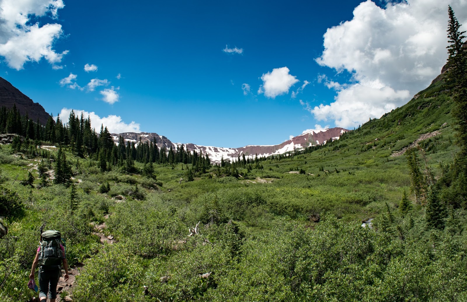
The area between West Maroon Pass is not only beautiful but very serene. You've got impressive alpine views the whole way, and the trail is very smooth and only moderately steep.
 |
| Climbing a little bit higher |
 |
| Making a short but steep push up Frigid Air Pass |
 |
| And this is what you see when you crest the pass |
Reaching the top of Frigid Air Pass was again, surprisingly emotional. I'm not sure what my deal was, but as I looked out over the vast and beautiful landscape unfolding before me, a tear welled up in my eye. To think that God put such beautiful places on this earth for humans to enjoy, really puts it all in perspective.
 |
| 3-shot Panorama of Fravert Basin |
 |
| Obligatory "Hero Shot" |
 |
| These little dudes were everywhere, and they were not afraid to get close |
 |
| Waterfall |
We made a hasty descent into the Fravert basin. I was ready for some dinner and ready to be rid of my large backpack for the day. Along the way we noticed some signs of bear activity. Mainly, scraped bark near the trail and the bear poop/pine needles thing they love to leave behind
Eventually we found a wonderful campsite with nearby water source and abundant "sitting logs"
 |
| Sitting logs are important! |
|
 |
| Tent site. It was a bit flatter then it looks like and was quite spacious. |
 |
| This was mighty tasty after a long day of hiking. Sunny Side Up from Pizza Boy |
We finished hiking at 5pm and honestly it felt quite luxurious to have all that time to relax and perform simple tasks like filtering water, setting up camp, and just kind of relaxing. For dinner I had Chicken Chili Mountain house, 2oz of Cheddar Sour Cream Ruffles, a Snickers Bar, 8oz of beer, and 12oz of hot chocolate. I ate a lot on this trip and honestly I feel like that was a good idea.
 |
| Google Earth representation of the route |
Part 2 can be found HERE