Crystal Peak 13,852'
From Aqueduct road (sort-of)
10 miles RT, 3200' of elevation gain
7/25/2015
Cameras used: Nikon D5100 and iPhone 6
I was looking for a hike to do with my friends who recently moved to Washington. They live just above sea level and were wary of their conditioning.
When we arrived in Breck it was 48 degrees and raining. Not typical July weather.
We were planning on Quandary but a combination of a probable late start on a Saturday and parking issues made me think something different would be better. The plan was to start at the Aqueduct road and hook up with the 4x4 road in Crystal basin. However, due to my lack of knowledge of the area, and a rougher road than anticipated, lead us to stop short and hike a chunk of the road. Fortunately hiking the road goes pretty fast, almost as fast as driving it in a 2WD rental Rav 4.
 |
| We parked at the creek crossing. Little did I know we were far from the aqueduct road |
 |
| Some nice trail on the Wheeler Trail shortcut/bypass |
The wheeler trail has a challenging creek crossing before joining the Crystal Creek 4x4 road. We eventually made it but someone got a foot in the river.
 |
| Stream crossing on Wheeler trail |
 |
| Wildflowers were abundant |
The meadows and dwindling forest were superb, the wildflowers were in full force. This early in the morning, there was no one to be seen.
 |
| Some Columbines in the wild |
Crossing the creek just below the lake was quite challenging, the road/trail brings you up to a portion where the outlet is almost 80' wide. I managed to rock-hop my way across.
 |
| Father Dyer on the right |
 |
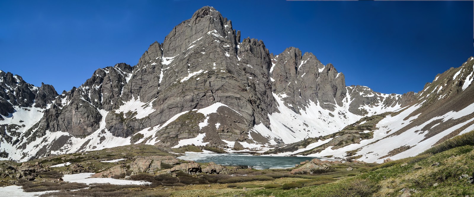
| 2-shot panorama. Crystal is distant left-center (with snow on it) |
On the other side of the creek, the trail very gradually makes it's way up the side of Peak 10.
 |
| 5-shot panorama of the lower basin |
 |
| We had to cross a snowfield about 50' long in late July |
 |
| Looking down on the lower Crystal Lake |
 |
| It's hard to believe this used to be a jeep road. |
 |
| Upper Crystal Lake, about 12,800' |
 |
| Hiking up tundra to the saddle at 13,200' |
 |
| Almost to the saddle... |
 |
| The saddle had wonderful views |
 |
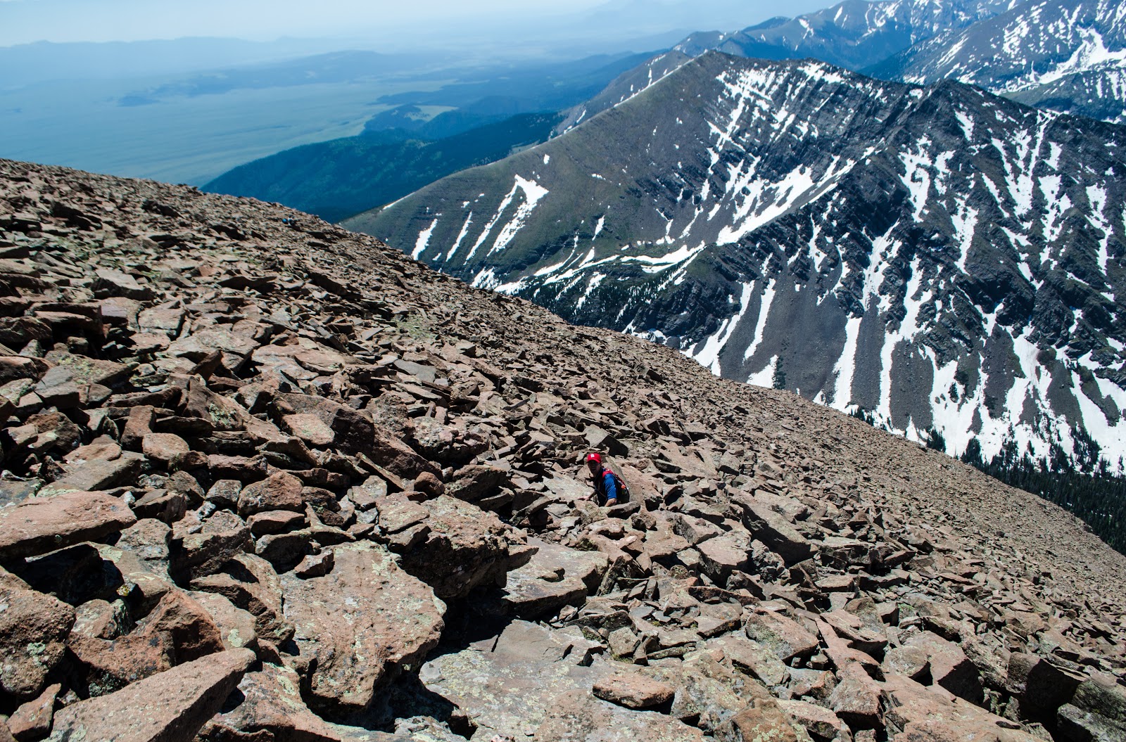
| Looking up the ridge, about 650' from the summit. |
 |
| 2/3 of the way up the ridge- this was nice solid class 2 hiking |
 |
| On the summit with Avery and Anastasiya. |
 |
| Just for fun :) |
 |
| It was Avery's B-day and his girls sang him "Happy Birthday" on FaceTime from the summit! |
 |
| Pacific Peak dominates |
 |
| Looking down at the mayflower gulch, Quandary standing guard in the distance |
 |
| Super Summit Panorama- Gore range left, Peak 10 right |
 |
| Peak 8, Peak 9 (notice the lift on peak 8) |
 |
| A nice and easy trail at this point |
 |
| Looking East |
After the hike we were able to enjoy the mild day by soaking in a salt water hot tub at 10,000', drinking some wine, and relaxing in the afternoon sun. But then it was time for dinner, so we headed to downtown Breckenridge to go to Relish. It's a nice place, I recommend it.
 |
| Looking happy after a long hike! |
 |
| Japanese Lantern Scallops at Relish |
 |
| Bonus pic from Sapphire Point |
The weather was fantastic, the scenery was gorgeous, and it was fun to hang out with my good friends whom we had missed since they moved. This was a nice route that didn't offer much of a challenge, but had nice views all around. Those seeking solitude should probably look elsewhere, as we saw quite a few people once we reached the summit.