Mt. Fletcher 13,951'
8/8/2015
From Blue Lakes Dam
I did this hike true "ultralight" style with only a few items- my phone served as camera and GPS unit, and a running hydration bladder. It worked out fine, although it was pretty cold and windy near the summit. GPS tracking and photos are from an iPhone 6 with no additional processing or editing.
The trail has been rerouted above the dam to avoid erosion. In addition, just like the 13ers.com route description mentioned, the trail effectively disappears above the lake. The route never really exceeded class 2 at any point, despite having to move around the cliff band/ snow gully. I suspect this snow will remain all year.
 |
| This large snowfield blocks access to the standard ascent gully |
 |
| Large flat area on the saddle with Quandary |
 |
| Quandary Peak (14er) at left |
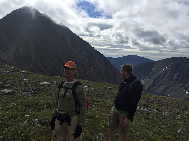
We were thinking about a traverse over to drift peak, but a couple things gave us pause. There were clouds building and visibility wasn't perfect. It was cold and a little windy. Unsure of the weather and also lacking proper gloves, I decided we should skip it this day. It was probably a good choice.
 |
| Looking over at unranked "Drift Peak" with the summit in the clouds. |
 |
| Little pan from the summit from Drift Peak over to Quandary and back |
 |
| Summit Selfie! You can see the clouds moving in. |
 |
| Drift Peak at left |
 |
| Taking a snoozer on 100 year old box springs |
 |
| Colorado Springs water supply huh? |
Afterwards we went to Breckenridge Brewery where I had a pulled pork sandwich and a Dark Rye-der Black IPA
GPS says:
2200' of gain
5.0 miles RT
 |
| GPS track imported into Google Earth |


